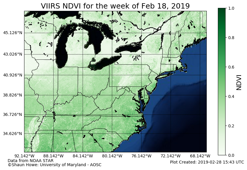
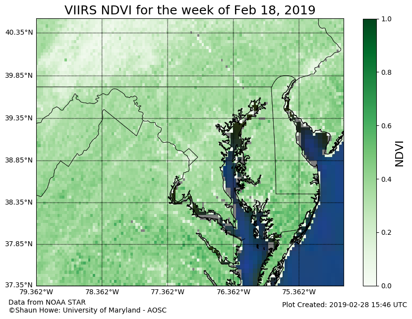
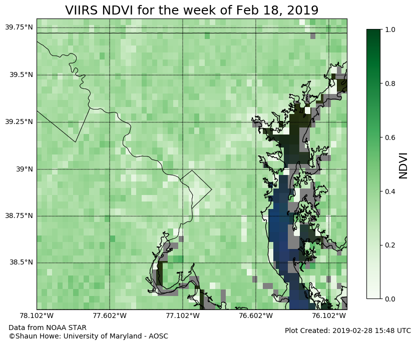
Near Real Time (NRT) Vegetation from VIIRS
The Visible-Infrared Imaging Radiometer Suite (VIIRS) is a scanning radiometer used in the Joint Polar Satellite System (JPSS). A radiometer works by measuring the power of electromagnetic energy. The VIIRS instrument measures aerosol properties, ice motion and temperature, and land/vegetation properties. Since the satellite is polar orbiting, VIIRS can view all the world’s land once a day. Of the 22 reflective and emissive bands on VIIRS, 5 of them are imagery bands with a 375m spatial resolution. The visible, near-infrared, and infrared bands are used for land vegetation observation. A useful measure of vegetation these bands is the Normalized Difference Vegetation Index (NDVI). This index utilizes the normalized differences between the near-infrared and infrared bands to provide a measure of spatial vegetation extent.
The data product use on this page was developed by NOAA STAR. This is a blended product which utilizes data from both Suomi -NPP (National Polar-orbiting Partnership) and PSS satellites. The temporal resolution of the data is weekly. Data can be accessed from this website.
Northeastern United States
Global
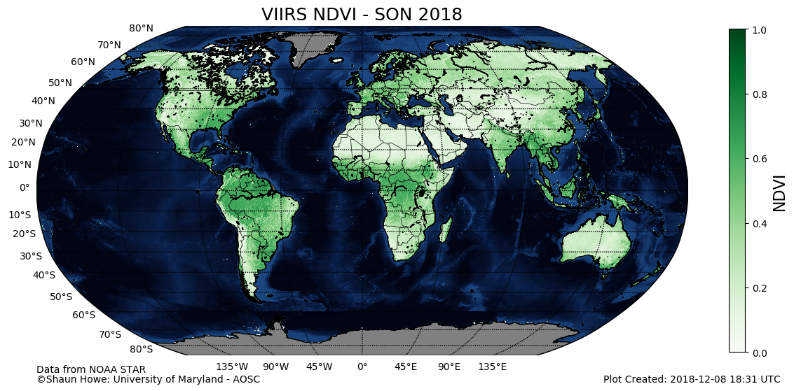
The figure to the left shows NRT seasonally averaged NDVI data from VIIRS. Data is ingested at a weekly time interval and averaged over the season. The averages are then plotted globally using the Matplotlib Basemap Python library. There is still considerable vegetation in the Northern Midlatitudes the fall.